当前位置:课程学习>>第六章 属性数据管理>>实践活动

设置坐标系统:
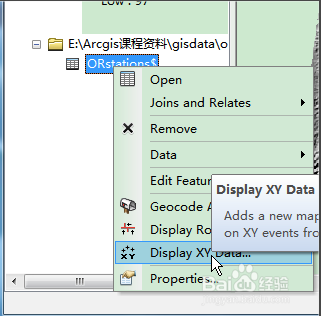
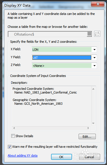
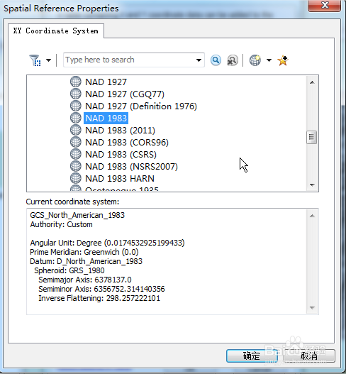
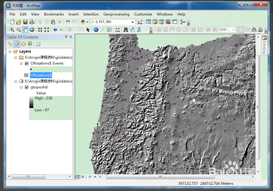
在ArcMap中右键点击表名,选择Display XY Data(显示XY数据),设置坐标字段。(X Field 为LON, Y Field 为LAT),单击Edit 按钮,设置坐标系统,选择坐标系统。(GCS采用NAD 1983):
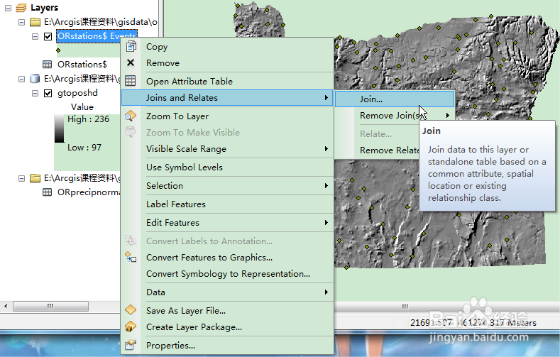
点图层与降水数值表关联:
添加ORprecipnormals.xls表以实现与orstation表关联,右击orstations表名,选择joins and relates下的join,选择station name 作为图层关联的基础,关联的表选择orprecipnormals,两表共同的属性选择station name,点击OK。
进入下一页